
Mangrove Forest Exploration in Banjarsari Village, Enggano Island
“Joint Research of Marine Science Study Program Students and Forestry Study Program Related to Google Earth Engine-Based Cloud Computing Study for Mangrove Carbon Stock Mapping with Medium Resolution Satellite Image Integration
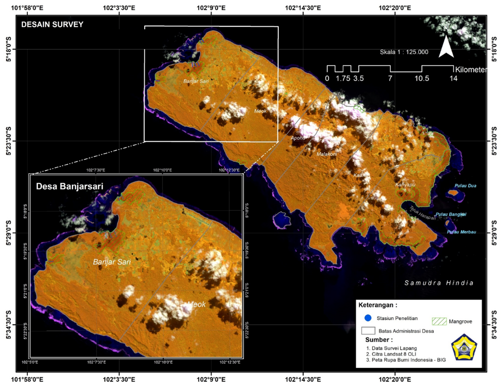
Enggano Island, January 29, 2025 – Students of the Marine Science Study Program and Forestry Study Program, Faculty of Agriculture, University of Bengkulu carried out collaborative research activities with lecturers, related to “Google Earth Engine-Based Cloud Computing Study for Mangrove Carbon Stock Mapping with Integration of Medium Resolution Satellite Images in Banjarsari Village, Enggano District, North Bengkulu Regency” The purpose of this research is to mapping of mangrove carbon stock estimation and spatial distribution of mangrove carbon stocks using Google Earth Engine-based Cloud Computing with the integration of medium-resolution satellite imagery. The results of the study are expected to provide biophysical data and information on the use of remote sensing technology using Cloud Computing based on Google Earth Engine and medium-resolution satellite image data to support global climate management
Banjarsari Village is one of the villages on Enggano Island that is directly facing the Indian Ocean. Ecologically, Enggano Island as a small island has dominant natural resources in the form of various ecosystems of important resources in coastal areas , both coastal and sea, such as mangrove ecosystems, one of which is in Banjarsari Village. Mangroves have several significant ecological benefits. Mangrove forests also serve as breeding grounds for various types of fish, shrimp, and other marine animals. The fallen leaves of mangroves are also a source of nutrients for the surrounding marine ecosystem. In addition, mangrove forests help maintain soil stability in coastal areas, reduce coastal erosion, and protect the coast from the impact of waves and storms as well as reduce carbon emissions by absorbing CO2 from the air.]
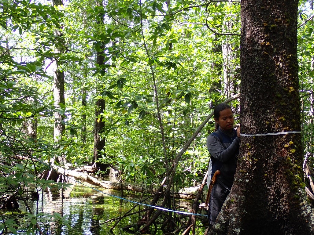
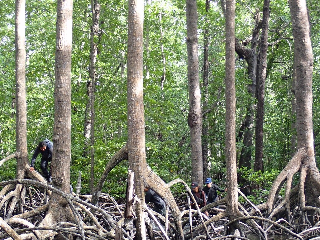
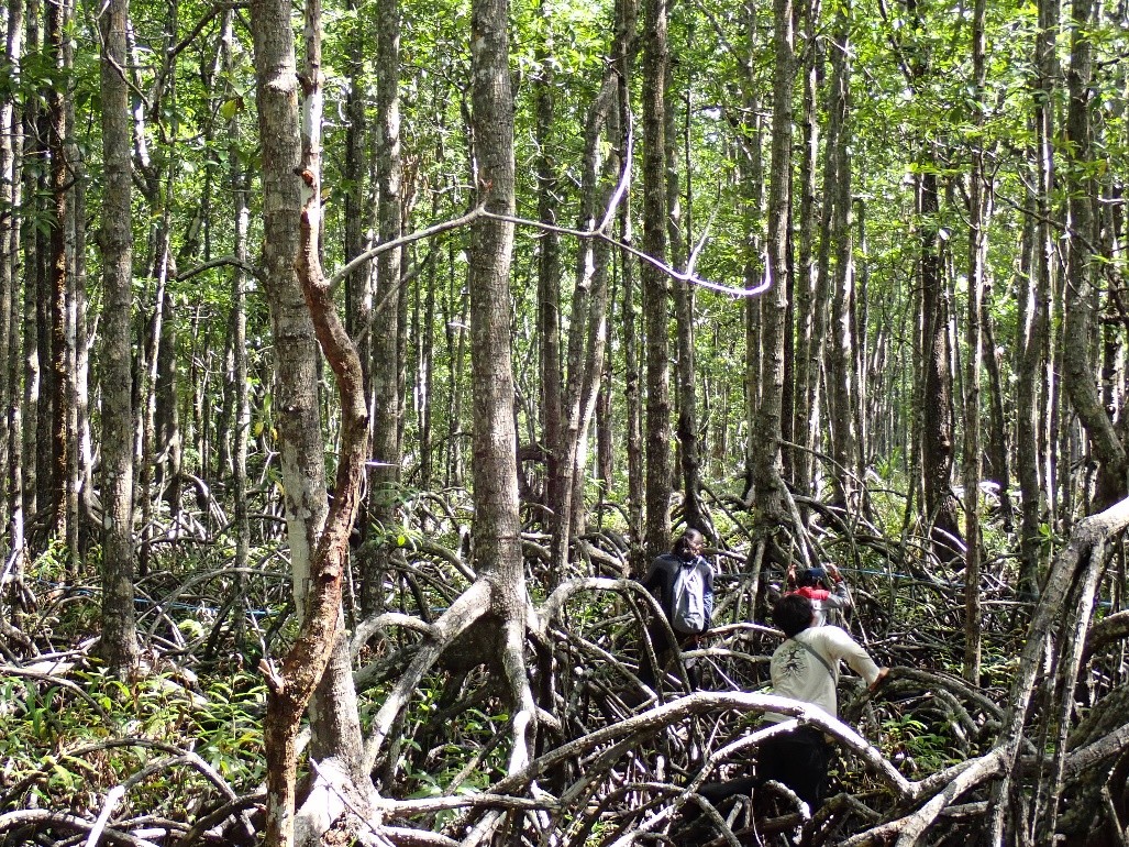
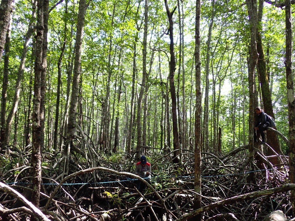
The research activity which took place on February 21 – February 27, 2025 involved 5 students (3 students from the Marine Science Study Program and 2 students from the Forestry Study Program) who were accompanied by the Field Supervisor – Marine Science Study Program, namely Mr. Ayub Sugara, S.Kel., M.Si. This research is a grant to fund the 2025 LPPM Fundamental Research of the University of Bengkulu chaired by Ayub Sugara, S.Kel., M.Si.
In the process, the team used direct survey methods and GPS-based mapping technology as well as satellite imagery to obtain accurate spatial data. According to Ayub Sugara, the mangrove ecosystem on Enggano Island has an important role in maintaining the ecological balance of the coast, including as a habitat for marine life and a natural protector from abrasion. However, the current spatial data on the condition of mangroves in coastal areas and small islands is a challenge in itself. “We hope that the results of this research can be the basis for making mangrove management policies in Enggano, as well as increasing public awareness of the importance of preserving mangrove forests,” he said.
This study not only conducted a direct survey in the field, but also utilized medium-resolution satellite imagery to obtain spatial and multispectral data. Through remote sensing technology, students can identify land cover, cluster mangrove vegetation, spatial distribution of mangrove carbon stocks and detect areas that are experiencing degradation or changes in land function.
In addition to the mapping aspect, this study also emphasizes the importance of mangrove ecosystems as carbon sinks, thus contributing greatly to efforts to overcome the climate crisis. “Enggano Island has great potential as a natural carbon storage area. However, there have not been many studies that specifically calculate the blue carbon potential of mangroves here. We want to open the data so that it can be used by local governments, conservation institutions, and local communities,” added Ayub Sugara.
The results of this research are planned to be published in the form of scientific reports and presented to local governments and local communities as a form of real contribution of universities in the development of remote areas and environmental conservation. As a follow-up, the research team plans to compile a scientific report, a map of mangrove distribution, and an estimate of the potential of mangrove carbon stocks in the Banjarsari Village area, Enggano Island, North Bengkulu regency as a form of real contribution of universities in environmental conservation to address the challenges of climate change in coastal areas and small islands.


